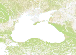
Map of areas surrounding the Black Sea. Mountains everywhere with most of the plains in the northwest and southeast. Centre of the map is dominated by water and there are several rivers going across the map. It has the island of Crimea, but most of the map is land. So, it is somewhat harder to attack in the map outside of Crimea. Most of the map is mountain, and the flattest part is Georgia. (Not to be confused with the state)
Technical
The size of the map is 1500 x 1100.[1]