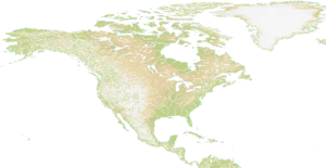
Map of Northern and Central America and Greenland.
Mostly hilly and mountainous terrain with some plains mostly near oceans and in the northern and eastern parts of the map. There are a lot of water and rivers.
Technical
The size of the map is 2800 x 1448.[1]